Agricultural guidance system geotrack explorer PLUS RTK

AGRICULTURAL GUIDANCE SYSTEM (COURSE INDICATOR) GEOTREK EXPLORER PLUS RTK
NEW GENERATION SOFTWARE. UNIQUE OPPORTUNITIES. HIGH ACCURACY THANKS TO THE GM SMART L1/L2 RECEIVER WITH SMOOTH MODE AND RTK.
GeoTrack Explorer PLUS is a new development of the GeoMeter company with the EVOLUTION series software, which provides precision at the level 1-3 cm from pass-to-pass. High accuracy is ensured by the presence of a GM SMART dual-frequency GNSS receiver. RTK corrections are required to obtain centimeter accuracy. You can use your own base station or purchase RTK corrections separately.
Forget about the loss of satellite signal during work and stopping equipment. With the new and state-of-the-art GM SMART GNSS receiver, your agro navigation system will always be in working order. Thanks to the simultaneous work with satellite systems GPS, GLONASS, GALILEO, BEIDOU, QZSS, IRNSS, you will always have a sufficient number of satellites for full-fledged work in the field. The average number of satellites in operation is over 35 satellites.
Installation of the Parallel Driving System will allow you to easily solve a number of tasks, including: precise control of equipment in the field, measurement of agricultural areas, complete rejection of signallers and the use of markers, the ability to work in poor visibility (at night, in fog, with strong dust), time saving, significant reduction in fuel consumption, fertilizers, plant protection products and herbicides.

The updated functions of the system include visualization and counting of overlaps in real time, quality control of work and the ability to synchronize fields and work with the office (Agroprofile system www.agroprofile.com). The new intuitive menu greatly simplifies the operation of the device.
FEATURES OF THE GEOTRACK SYSTEM WITH GM SMART RECEIVER:
| Coordinate smoothing mode, which is specially designed for parallel driving systems. Accuracy on a free signal at 15 cm. Stable accuracy at no additional cost. | |
| There is support for software unlock up to the level of a dual-frequency RTK receiver. The ability to work from GNSS RTK corrections network with a distance of 50 km from the base station with an accuracy of 2.5 cm. |
During operation, guidance on the heading screen helps ensure accurate driving by preventing rough spots (blemishes) and reprocessing areas (overlaps). The parallel driving system is equipped with a GM SMART GNSS receiver for receiving signals from GPS, GLONASS, GALILEO and BEIDOU satellites + receiving SBAS correction signals: EGNOS, WAAS, MSAS. GNSS receiver GM SMART can work with centimeter accuracy from any CORS network via the Internet and from its own base station. The distance from the base station can be more than 50 km.
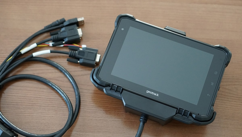
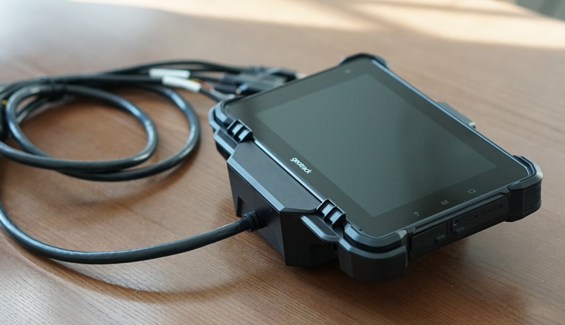
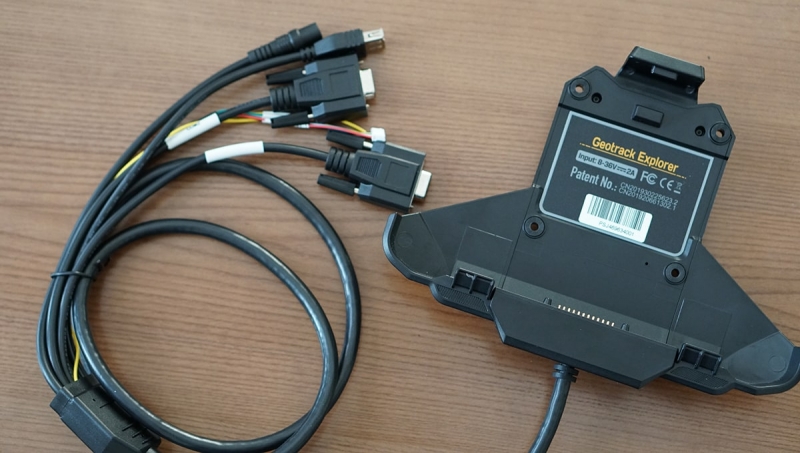
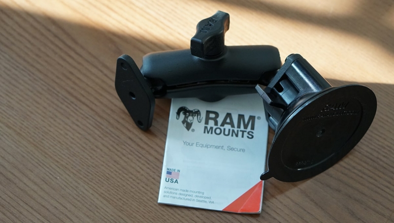
The system has a 7-inch (17.8 cm) screen that is easy to read even on a bright sunny day. A high screen resolution allows you to see a clearer picture. The night mode is convenient for vision. The display is protected from dust and moisture. The set includes a reliable vibration-resistant metal RAM mount (USA). Available RS232 connectors for connecting external devices such as auto steer and sprayer section control module.

CHARACTERISTICS
- Display: 7 inches (17.8 cm)
- Case: durable plastic, metal, tempered glass
- Number of channels: 698
- GPS receiver: GM SMART L1/L2
- Parallel Driving Accuracy: Centimeter
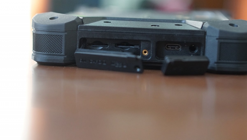
- Port: USB-C
- Connector: RS232 x 2
- Built-in memory: 16 GB
- Memory card: micro SD
- Communication standard support: 2G / 3G / 4G
- Battery capacity: 5000mAh
- Mount: RAM (USA)
VIDEO REVIEW OF GEOTRACK EXPLORER PLUS:
FUNCTIONS:
- Precise parallel driving (SMOOTH mode, RTK mode)
- Accurate area measurement (SMOOTH mode, RTK mode)
- Processing stored fields
- Determination of the treated area
- Determination of overlaps %
- Painting the treated area
- Display of driving speed
- Azimuth display
- Five driving patterns
- Setting the working width (up to centimeters)
- Online help in the field (remote connect to the device)
- Save Field Map
- Saving works
- Indication of the type of work (sowing, spraying, etc.)
- Online communication with Agroprofile
- Work planning in Agroprofile
- Execution of works on schedule from the list of works
- Online monitoring of work execution (updates on the server every 15 seconds, provided that mobile Internet is available) - 12 months free of charge, then (option) $ 60 / year
- Automatic shutdown of sprayer sections (optional)
- Auto steering connection (optional)

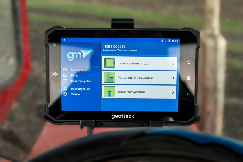
GUIDANCE MODES:
- Field area measurement
- Measuring the area of fields with offset
- FREE mode
- Straight A-B
- Curve A-B
- Perimeter-Straight A-B
- Perimeter-Curve A-B

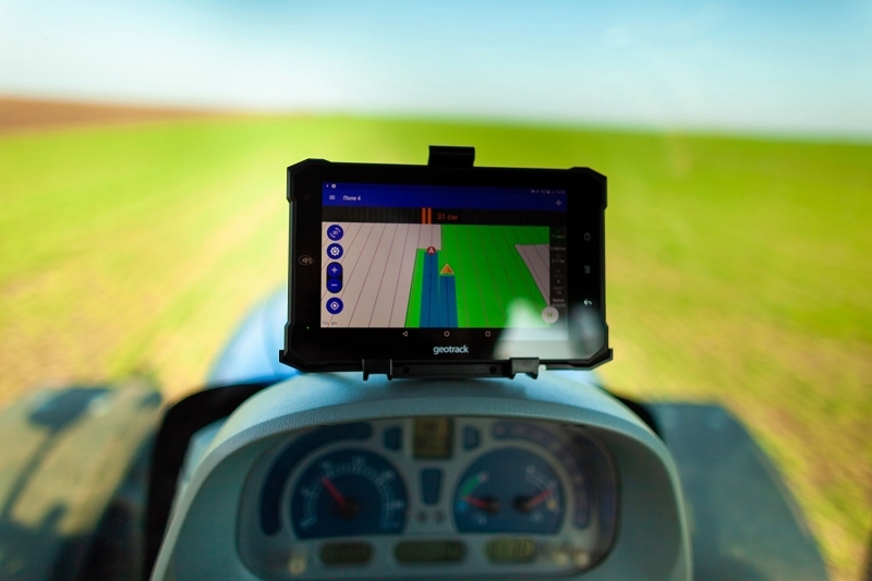
DISPLAYS DATA WHILE MOVING:
- Treated area
- Total traveled length
- Speed
- Number of satellites
- Satellite signal quality (HDOP)
- Visual control
- Counting the running time
- Overlap display and count
- Ratio: work done / work remaining
- Ratio: worked area / overlap area
Guidance mode 2D / 3D
Day / Night Mode
- manual switching
- automatic switching at a specified time

Work scheduling (can be used as desired):
In the Agroprofile personal account, a job is assigned, which on the specified day is displayed automatically in the "View Works" section:
- "New works"
- "Works to be continued"
- "Completed works".
ADDITIONALLY
- Official product page
- Free online system Agroprofile
VIDEO DEMONSTRATION IN WORK:
HIGH ACCURACY OF WORK
The Agricultural guidance system GeoTrack Explorer PLUS GM SMART is equipped with a high-quality dual-frequency GNSS receiver GM SMART, which was developed specifically for high-precision parallel driving.
QUALITY CONTROL OF WORKS
The new software for the GeoTrack Explorer PLUS devices has many functions for determining the quality of work: displaying the worked area, highlighting overlaps with a darker color, calculating % of overlaps. The system automatically records the quality of field processing in real time. Now you will know exactly how well the field has been processed.

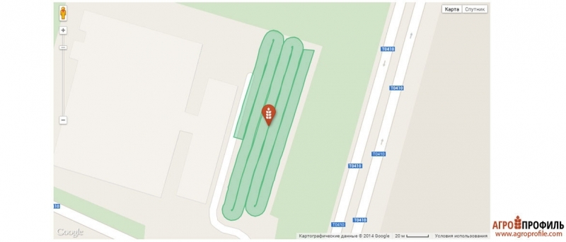
FULL SYNCHRONIZATION WITH THE OFFICE
Parallel driving system GeoTrack Explorer PLUS have a built-in WI-FI module, as well as a slot for installing 3G SIM cards. With the help of wireless data transmission, the GeoTrack Explorer PLUS heading indicator will be constantly in touch with the Agroprofile online office. The manager or accountant will be able to monitor the progress and quality of work in real time. The entire eco-system from GeoMeter allows you to change the quality of preparation and work performance for the better.
ONLINE TECHNICAL SUPPORT
It is very important to get technical support from the supplier at the right time. And GeoMeter Company has taken this into account in its new development: all GeoTrack Explorer devices can be checked and serviced using remote access, a company specialist will be able to connect to your display without leaving the field. To use this function, you will need an installed SIM card with activated Internet access, or an Internet access point via Wi-FI.

FUEL ECONOMY
Accurate, parallel driving from pass-to-pass will prevent you from returning to the covered sections to rework them. The processing of the field will become controlled and more accurate for you.
SAVE TIME AND MONEY
The GeoTrack parallel driving system is capable of operating at any time of the day, in any weather, in fog, dusty conditions and poor visibility.
ECONOMY OF HERBICIDES AND SEEDING MATERIALS
The GeoTrack navigation system will allow you to accurately control equipment between the rows, which in turn will allow you to correctly and economically distribute herbicides, seeds and other resources during field work.

MAXIMUM OPPORTUNITIES WITH AGROPROFILE SYSTEM
The free online system Agroprofile will complement the functionality of the GeoMeter and GeoTrack navigation devices with a full-fledged planner of agricultural operations, the ability to obtain extended information about each field, including the weather for each field area, the history of field processing and much more. Accounting, control, planning and analysis of the efficiency of work processes - the Agroprofile online system will help to cope with all these tasks.

- Producing country Ukraine
- Display 7 inches (17.8 cm)
- Body Durable plastic, metal, tempered glass
- GPS receiver GM SMART 2
- Manufacturer GeoMeter
- Display protection dust and moisture (IP68)
- Accuracy 1-3 cm
- Types of signal GPS/GLONASS/GALILEO/BEIDOU
- Update frequency 1 Hz, 10 Hz, 20 Hz
- Antenna cable 4 m
- Port USB-C
- Memory card slot micro SD
- Wireless standard 2G/3G/4G
- Battery capacity 5000 mAh
- Mount RAM (USA)
- Synchronization with Agroprofile automatic
- Display included yes
- Type of connection to GPS receiver Bluetooth


Следует отметить, что не все системы автопилотов и автоматического подруливания могут быть установлены на тракторы МТЗ. Автопилот к трактору МТЗ должен позволять его переоборудовать и быть совместимым с рулевой системой.